Thinking of renting a car? Here's what you need to know to get to Puerto Viejo
Esa página está disponible también en español.
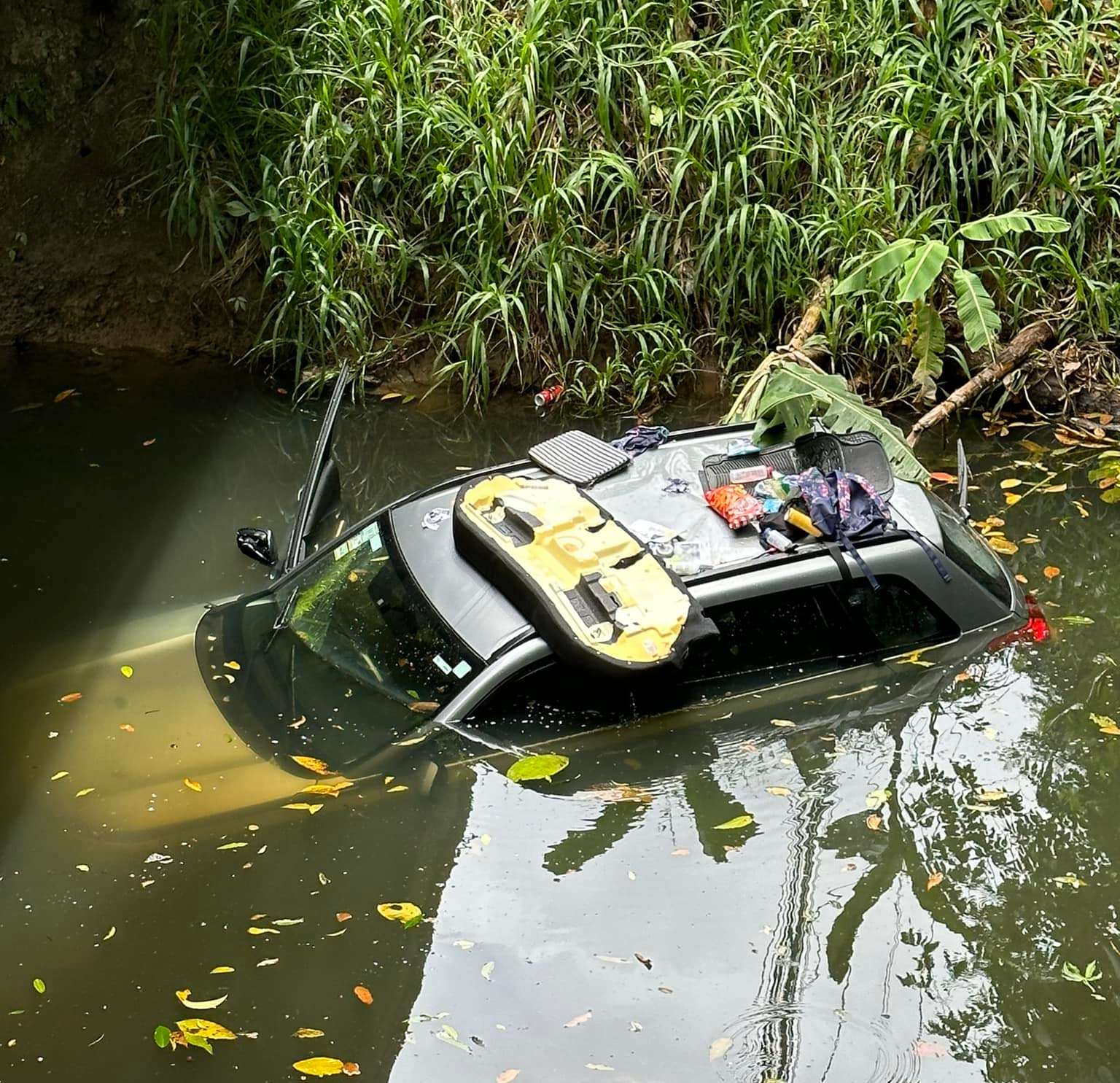
Photo 1 of 3. Click to view slideshow.
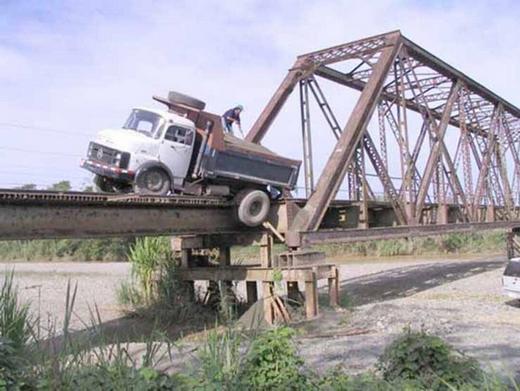
Don't be that person who speeds on the road south of Puerto Viejo. If you don't hit a pedestrian or cyclist you may end up like this driver who went right off the Rio Negro bridge at Playa Cocles.
Road Conditions
The roads are sometimes affected by mudslides and other conditions, especially the highway between San Jose and Siquirres. When this highway is closed, traffic is detoured via Turrialba (which is option 2 desribed below). To get current information on road closures you can try the options we've listed below. Look for that status of Ruta 32 (which is the main part of the principal driving route, see detailed instructions below) or Ruta 10 (if you're taking the route via Turrialba. You can also try putting your destination into Google Maps or Waze (you will lose cellphone data coverage so do this before you leave the Central Valley) as they may have updated traffic info in the case of a detour or heavy traffic.
- RutaAlterna.org website
- Call the traffic hotline number of the traffic police (transito) which can give you recorded info (in Spanish). From within Costa Rica dial 800-TRANSITO, option #1, option #4.
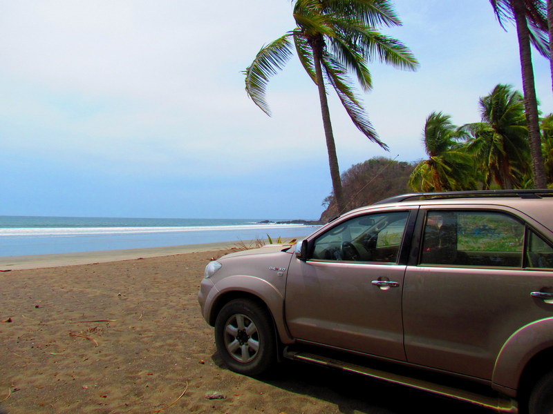
Don't be that douche who drives your car onto the beach, ok? Keep to the roads.
Car Rental
If you're considering renting a car and driving to Puerto Viejo, all the major international car rental companies operate at or nearby San José International Airport as well as in downtown San José. Keep in mind that rates quoted online generally do not include any sort of insurance (which is sometimes even more than the rental rate) and that the car rental companies will definitely require proof of coverage elsewhere before agreeing to let you waive any insurance coverage they will sell you. Search rental car rates from San José here.

Please also keep in mind that only two car rental companies currently have offices in the South Caribbean area. Adobe EasyCar and Alamo Enterprise both have offices in Puerto Viejo center. They will generally also deliver cars to local hotels. So if you want to pick up or return your car in Puerto Viejo, those are your only choices. If you're flying into Limon airport you can also arrange a car rental from Limon and ask them to deliver it to the airport to meet your flight.
Car Rental Puerto Viejo Car Rental San José Car Rental LimónDriving directions San Jose to Puerto Viejo
There are two routes possible if you're driving:
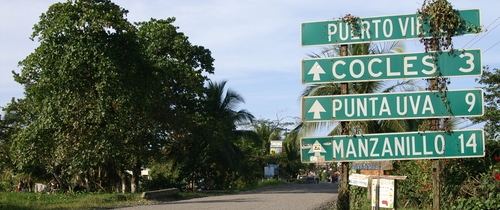
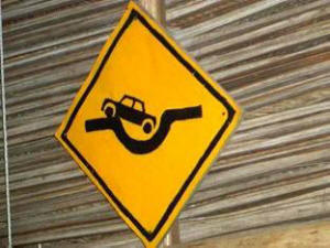
When you see this sign, you're almost here!
Option 1: Via Guapiles, Siquirres, Limon
Driving to Puerto Viejo is really easy (except for road conditions at times). You will have to find the highway to Limon. It has easy access from downtown and once you are on that highway, it is almost impossible to get lost.
Please note that if you have not left San Jose by 2:00 pm in the afternoon, you will be driving part of the way at night. We do not recommend this for first time travelers in driving in Costa Rica. Roads do not have lines. Rain can be bad and there are potholes and people walking or cycling that you cannot see very well.
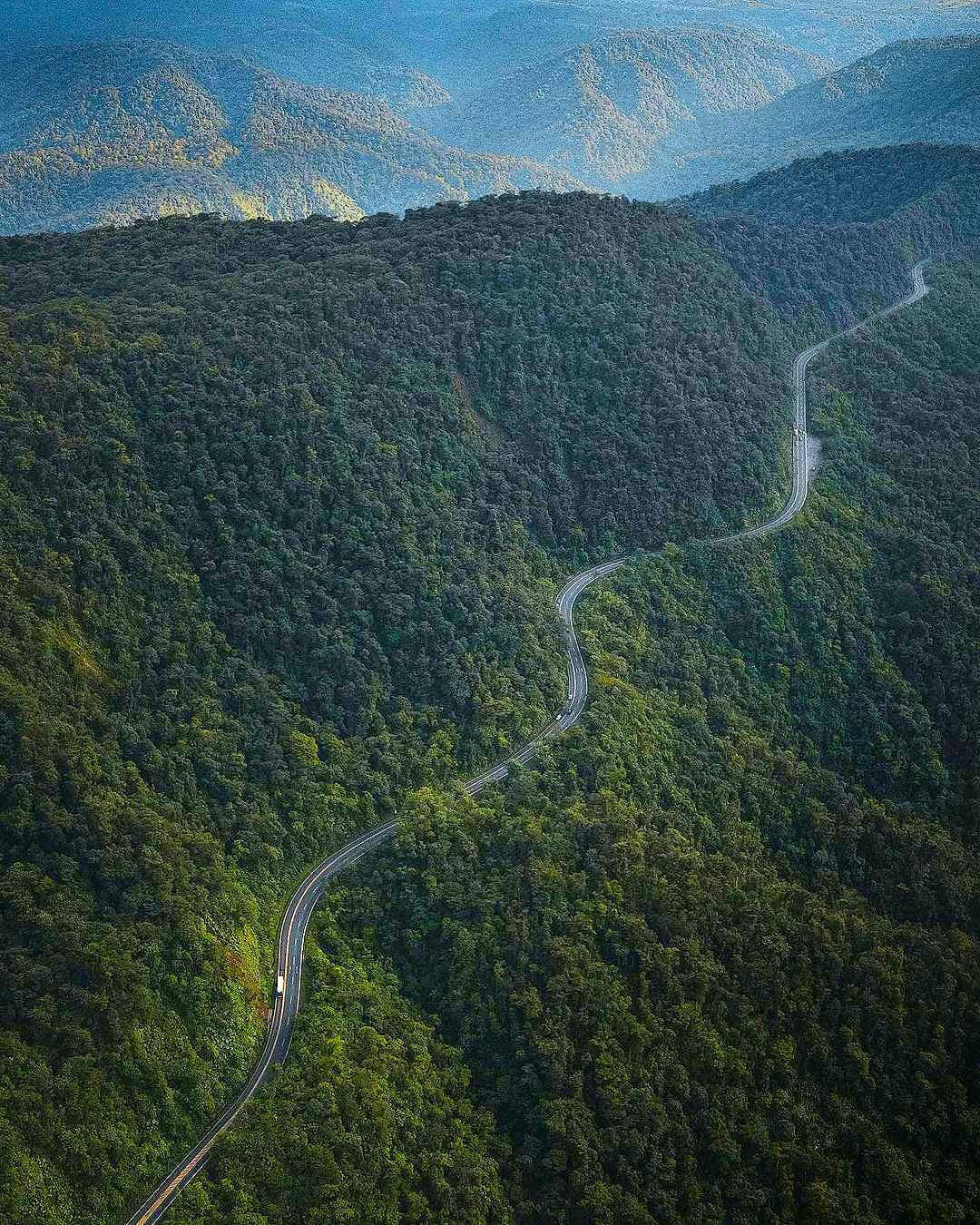
You will first go through the mountains and will be very high up. It is likely that you will encounter fog (clouds) and rain. Please drive with your lights on. Half of the local drivers do not.
The drive through the mountains is beautiful. You will see many vistas and real rain forest jungle. As you are about to exit mountains into flat land (just after a bunch of ugly billboards) there is a restaurant on your right (usually with many trucks out front). It is called El Yugo and it is a very good cafeteria style local restaurant. It is also a good break after about 1.5 hours into the trip.
If you want something a little nicer, just a few hundred meters on the other side of the road is Roberto's Rancho. Sit down with table service and very good local food. Guard watches over your car (please tip him $1 or 500 colones). Always be mindful if you stop at places to eat that you do not leave your car and valuables unattended.
The road from there to Limon (approx 2 hrs) is practically straight with no hills. It is small towns and banana plantations. Please note there are many trucks as Limon is a port city and this is the truck route. Also note, you may see a sign or two for Puerto Viejo on the way to Limon. This is not the correct Puerto Viejo. You have to almost reach Limon and then drive down coast.
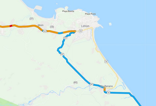
You'll avoid Limón center if you turn at route 241 and save a few minutes but then aren't you eager to get your first glimpse of the Caribbean sea?
Shortly before you arrive in Limon you will see signs for Cahuita and Puerto Viejo that will take you south via highway 241/Rio Banana which will save you about 10 minutes. It's also fine to continue into Limon and just take a right at the coastal route 36 to go to Puerto Viejo. From the turn it's about 30 minutes to Cahuita and 45 minutes to Hone Creek where the turn-off is for Puerto Viejo.
When you arrive at the little town of Hone Creek you will see a gas station Servicentro Hone Creek, this is your last chance for gas, there is no station in Puerto Viejo nor in the communities south of town. The turn-off is shortly after the gas station and several large supermarkets and is well marked.
From Hone Creek the main highway 36 continues on to the Panama border at Sixaola and the other road heads about 5 km into Puerto Viejo. Just 1 km before Puerto Viejo you will find the community of Playa Negra. To get to the communities of Cocles. Playa Chiquita, Punta Uva and Manzanillo, drive through Puerto Viejo and continue following the beach road.
Option 2 - Via Cartago, Turrialba, Siquirres, Limon
This route is mentioned for when Route 32 is closed through Braulio Carillo Park (a not uncommon occurence) or for the convenience of more experienced drivers who would like to take a different route or who are starting their trip from the eastern part of the Central Valley (such as from Cartago). It is a very scenic route and the roads are some of the best in the country.
Again, once you find the highway to Turrialba, it would be difficult to get lost but you will need to navigate to Cartago and onto the Turrialba highway first. It would be simpler in the other direction though as there are more signs pointing towards San José. From San José to Puerto Viejo by this route takes a little longer, perhaps 5 hours.
There are several signs in San Jose pointing you towards Cartago, and several signs on the way to Cartago. If you stay on the main road leading into Cartago and go until the street ends (you will have just passed the Basilica - a very large, beautiful church) on your left. You would turn right at the stop sign and then left at the next stop sign (100 meters). This is the road to Paraiso. You'll continue on about 6km before you reach the center of Paraiso, marked by the usual church and park. Once you reach the stop light at the corner of the park, you'll continue one block and take a left. You'll see signs pointing you towards Turrilalba.
This beautiful, windy road will lead you directly into Turialba. It will take you about 1 hour and 20 minutes from downtown Cartago, or 1 hour from Paraiso. Once you are at the bottom of the very steep hill and you enter the actual town of Turrilalba, you'll want to stay on that main street (many people will be turning left) until it looks like the street is ending (several blocks). You will see signs for Limon telling you to turn left. At the next street light, maybe 2 blocks ahead, you'll turn right, again following the sign to Limon.
This continues on another windy and scenic road. After about 30 minutes you'll come to the outskirts of the town of Siquirres. You'll see a sign on your right telling you to go straight ahead for Siquirres or to turn left to go to "San Jose 99km." Take this left. (The sign to Limon has been stolen.) Once you turn left, you are brought around a circle and are dumped out at a very major road. Go left to head to Limon. One hour later you'll find yourself in downtown Limon.
From there follow the directions above in route 1 to Puerto Viejo.
Driving from Arenal to Puerto Viejo
You can avoid San José if you are coming from Arenal. Follow these instructions:
1. Leave La Fortuna to the west towards Tanque/Muelle S. Carlos/Aguas Zarcas
2. In Tanque you have to turn left (small intersection right in town)
3. Follow the street until it goes down and immediately uphill again, there turn right towards Muelle S. Carlos/Aguas Zarcas
4. In Muelle San Carlos there is a big intersection where you go straight ahead
5. Once the street ends, turn right and follow the street until you are in Aguas Zarcas
6. In Agua Zarcas, turn left (right in town) and keep following the street until you reach San Miguel de Sarapiqui (end of the street)
7. In San Miguel de Sarapiqui turn left towards Puerto Viejo de Sarapiqui
8. Follow the street until you reach Puerto Viejo de Sarapiqui
9. Take the first street (bigger) to the right and you will pass a petrol station and afterwards a bridge
10. Follow this street until you reach a big intersection (it is the N32 coming down from San Jose), there turn left
11. Stay on the N32 until you reach Limon
12. From Limon on, follow the signs to Cahuita/Puerto Viejo/Manzanillo
13. Once you have passed Hone Creek leave the main highway and take the marked turn for Puerto Viejo. Follow it until you can see the sea.
14. Turn right for the last kilometer into downtown Puerto Viejo
Looking for other transport options?
There are plenty of other ways to get here: public bus, shuttles, whitewater rafting, flying and more. Check our transport overview page for all the options.